Lessons from the Network: Mike Kline

This interview was conducted in summer 2024. It has been lightly edited for clarity.
River Network (RN): Can you give me a brief introduction to who you are and the role you played at Vermont Department of Environmental Conservation (DEC)?
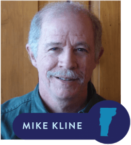
Mike Kline (MK): My name is Mike Kline. I started with the Department of Environmental Conservation in 1988 working as a watershed planner doing basin plans under Clean Water Act programs. I was eventually teamed up with the State River engineer to create a Rivers Program in Vermont. I worked for my first 10 years as the State River Scientist. And then I served as the Rivers Program Manager for the last 10 years of my career.
RN: What was the impetus for you and others to develop the Functioning Floodplain Initiative? Who and what were the primary drivers of getting this policy put in place?
MK: One of the key things that occurred is that the Vermont DEC brought together a river ecologist, a river engineer, floodplain managers, and the hydrology section of the department to create the Rivers Program. We had a multidisciplinary program staff that was paid for by a suite of federal and state agencies including FEMA, EPA, and the state Water Quality Division of the DEC. One of the things that always surprised me when I traveled the country was how unique it was to have all of those different pieces brought together into a single program.
We became very interested in the physical conditions of our rivers and floodplains and started conducting stream geomorphic assessments. This interest was not only because we were dealing with and administering the National Flood Insurance Program, but it was also because we were looking at development pressures and social issues around floodplains and flood impacts.
We identified that many of our streams had become disconnected from their floodplains due to historic river and floodplain management practices. We documented that 75% of our rivers were not connected to their floodplains. By connection, I mean able to annually spill out over the banks and inundate the floodplain (e.g., during spring runoff events).
The very important message was that Vermont’s damages during floods were primarily related to erosion. Erosion in a mountain state like Vermont is related to the fact that all the flow of a flood is being contained within these erodible banks of stream channels because they weren’t spilling out onto their floodplains. All that contained energy from the flood has caused explosive erosion during some of these increasingly large flood events that we are having in Vermont. So, the floodplain began to take on a much broader meaning to us than a feature that we were regulating through the National Flood Insurance Program through FEMA’s minimum standards.
That really kickstarted our look at floodplains and all the work around protection and restoration that we began in Vermont, which then ultimately led to the Functioning Floodplain Initiative.
We based our river corridor mapping on all the stream geomorphic data that we had collected over the years. For the state to enter a statewide regulatory regimen, we needed comprehensive river corridor and floodplain maps. You can’t set up a regulatory regimen and not give notice about how these regulations are going to be applied. We had to take our assessment program to a new technical level by developing the tools of the Functioning Floodplain Initiative (for modeling and tracking gains and losses in floodplain connectivity).
RN: You have connected all these dots, the different silos that were connected under the Rivers Program. How was Vermont dealing with or managing floodplains before the Rivers Program was established?
MK: Like everywhere else in the country, when the private insurance business pulled out of protecting people and floodplains, the federal government took over, and created the National Flood Insurance Program. To enjoy the affordable rates, they required municipalities and other regulatory agencies to adopt minimum standards which said, stay out of the floodway. But there was basically a free-for-all in the flood fringe, which is typically the largest percentage of the mapped 100-year floodplain (the flood fringe and the floodway comprise the floodplain).
And that’s how Vermont was managing its floodplains. We now realize that we were actually helping to develop our floodplains. This all changed when we realized that our rivers were not only incised (downcut) and disconnected from their floodplains, but many had been straightened, and they were evolving. All this erosion was largely a result of our rivers creating new floodplains. They were widening their channels, re-meandering, and building new floodplain features. Documenting this process, we realized that there was a certain amount of space in the valley that we needed to preserve for this evolution to take place.
RN: How did you successfully create the conditions and advocate for this programmatic change? How long did it take? What strategies and tactics did you use? Where did support for the changes come from?
MK: The need to protect our river corridors and floodplains came to a head when the Program had to respond to its first really big disastrous flood, and that was Tropical Storm Irene in 2011.
But the stage had been set. We had developed the science, we had developed the policies in the regulatory arenas. Where DEC did have some land use authority, we were applying river corridor protection.
We had worked from one end of the state to the other involving citizen groups and watershed associations in the development of the science. We had invested in outreach and education about the importance of river corridors and evolving floodplains. When that flood hit, we were poised to go to the legislature to get the state more involved in protecting river corridors and floodplains. That’s when the authority was granted for the state to develop its first set of rules around how these features should be protected where the state had land use regulatory jurisdiction.
We have both floodplain managers and river engineers in the Rivers Program, and they are situated in regional offices, so they are better connected to the local communities. They know the local planning commissions. They know all the local road foremen and many of the farmers. When a disaster hits and your people have spent their careers building relationships and trust at that local level, they are the ones people turn to during recovery.
After Tropical Storm Irene, I was able to go into the legislature and explain that I have only three engineers covering the entire state and they worked 16 hour days during the post-Irene recovery. I explained the need to build the program. I could tell story after story after story of the relationship between the Rivers Program staff and the local communities.
They responded by not only giving us expanded authority, understanding that we have to minimize our footprint in these natural features that are protecting our communities, but also that we need people on the ground that can help.
RN: What organizations has the state partnered and built effective coalitions with? What work did you do to build trust, designate roles and responsibilities, and successfully come together?
MK: After the flooding associated with Tropical Storm Irene, a tremendous amount of mitigation dollars came into Vermont.
Everybody came to the Rivers Program for answers: “How do we apply this money effectively? Where do we spend these millions of dollars to mitigate hazards and reduce our damages?”
I could point to this stack of reports on the wall and say, somewhere in these stream geomorphic assessments—the projects identified by consultants—are great ideas.
Suddenly, many of our agencies—Vermont Agency of Transportation, Vermont Emergency Management, Vermont Commerce and Community Development—were all coming to the Rivers Program and saying “how do we make ourselves safer?”
In addition to whatever projects we could generate with our data, we pitched the idea of making our data and our maps accessible to everyone online. We needed to develop the ability to analyze the “what ifs” through modeling. What if we did this project? How would it affect the connectivity and the hydrology of the river? The Vermont Emergency Management agency, which conducts our state hazard mitigation planning, identified a need for a functioning floodplain initiative. The state hazard mitigation plan opened the door to FEMA planning money that is calculated as a percentage of the damages awarded in a declared disaster. The planning money was then applied both at Vermont’s transportation agency and at DEC to start building the modeling tools. The Functioning Floodplain Initiative was one of them. Of course, the other huge partner was EPA’s Lake Champlain Basin program. EPA had just revised the total maximum daily load (TMDL) for Lake Champlain which required a phosphorus load reduction from all the responsible sectors that had been identified. Earlier, DEC had successfully convinced EPA to evaluate the amount of phosphorus runoff coming from unstable tributary streams that were evolving. Their consultants calculated that 21% of the load was due to this stream and floodplain instability.
We had been working with all the various agencies at the both the state and federal level to explain why stable, minimally erosive streams and functioning floodplains (the outcome of the stream evolution process) were in the interest of their sector or of their constituency. With the state transportation agency, for example, the damages that they saw and the dysfunction and maintenance that they were addressing in the highway system that crossed over and alongside our narrow river valleys was in part because decades of mismanagement had created incised, eroding, and evolving channels. So, the transportation money was flowing in for practices consistent with stream equilibrium processes. After several years of working with NRCS and our State Department of Agriculture, we showed that protecting the floodplain re-development process was in the interest of Vermont farmers. So, Farm Bill money was flowing into an array of stream and floodplain projects and assessment work on agricultural lands. The Vermont and Federal Economic Development Agencies, especially after Irene, began putting a lot of money into both mapping and outreach assistance to work with municipalities on their regulatory programs for both floodplains and river corridors. It was a real multi-pronged effort that showed a functioning floodplains initiative was in all of our interest. It was a win, win, win, win.
One other important partner has been our land trust community. Before Irene in 2011, we recognized a need to work with landowners, farmers in particular, because we were asking them to take an economic hit, to give up a particular cornfield or pasture to the movements of the river. We developed the Vermont River Corridor Easement Program by allocating money to purchase not only the development rights, but the channel management rights within that. We established relationships with the Vermont Land Trust, the Vermont River Conservancy, and a lot of smaller land trusts around the state, and the Nature Conservancy to engage their landowners about this program. With the purchase of those rights, the landowners are compensated for their economic loss, and the rivers continue to evolve within the conserved corridor.
RN: Was there opposition to the Functioning Floodplains Initiative? Who was opposed? How was the opposition diffused/overcome?
MK: There’s broad agreement that being right next to rivers, living right next to a river, is not safe. People disagree about whether a particular new development next to the river will hurt anyone else. Most developers are willing to take the risk, and there’s always going to be individual cases where somebody wants to challenge the restrictions that apply to their land. Fortunately, in Vermont, court challenges have resulted in language that confirms the state’s authority to implement these measures. When it comes to public safety, restrictions on the use of private land can be justified. The “takings” argument is muted when it comes to public safety.
With the new law Act 121 just passed this year, authorizing statewide river corridor regulation and the municipal adoption of higher state floodplain standards, there will be new legal challenges. It will quiet down as the new regimen becomes better known and understood.
There’s certainly a contingency of folks in Vermont and around the country that think the solution is to get into rivers with yellow machines after a flood and restrain them and dredge them. I hope that this community of people is dwindling as more people learn that this approach is counterproductive and quite possibly sets us up for even more damage during the next flood.
RN: Developing a new initiative is a big accomplishment, but we know it isn’t the end of the story. Can you describe what implementation has looked like so far? How is the state continuing to work with affected communities and local governments to make sure the initiative is actually being well implemented?
MK: With last year’s disastrous flood, which I understand was even more costly than Tropical Storm Irene, the legislature picked back up on the discussion of river corridor and floodplain protection. Two weeks ago, they passed a bill (now enacted as Act 121) giving the Rivers Program the regulatory authority over all development in river corridors, and they expanded the program by five or six new staff. There’s a ramp-up period of a couple years for outreach and mapping. The Rivers Program is going to formalize the mapped infill areas so communities know where it’s safe to develop.
This new law also requires municipalities to adopt the standards for floodplain management that the state has developed, likely the “no adverse impact” standard, in the next few years. That takes it to the stratosphere for Vermont in terms of protecting both river corridors and floodplains. Municipalities are required to send all development proposals or draft permits to the Rivers Program to ensure what they’re permitting meets the adopted standards.
RN: Since you have retired, how are you still engaged with the implementation of the Functioning Floodplains Initiative?
MK: I’ve just decided to stop seeking new work as a paid consultant and to volunteer to support efforts like the Functioning Floodplain Initiative. I occasionally enjoy a coffee with the current manager of the Rivers Program to discuss what’s going on. With the passage of recent river corridor legislation that also requires municipalities to adopt the state floodplain management standards, the state rules will be revised, and there will be a lot of attention to how the state maps the areas that are considered safer to develop. As someone who wrote the original set of river corridor procedures, I hope to offer a lot of ideas on how to move those state regulations forward.
RN: What aspect of your work to develop and shepherd the Initiative are you most proud of?
MK: I’m proud of the fact that the light bulb went off for me about the importance of protecting river corridors. Through a lot of work with a lot of people, I’m proud that we developed the science to actually create the Vermont river corridor and all that has meant around the state. I also have to say that the co-development of the Vermont Rivers Program is something I’m extremely proud of because, as I said in the beginning, most states don’t have a Rivers Program to speak of that has all of these disciplines under one program, all of these regulatory programs under one manager.
When you go into the Functioning Floodplain Initiative web page and you want to see what a project is going to achieve in terms of a phosphorus load reduction for the Lake Champlain TMDL, you can press a button and see how many dollars that it may save in terms of erosion damages and inundation damages. You can also hit a button and see what kind of ecological values are going to come out of that project in terms of both instream and floodplain ecosystems. So, creating these tools helps to cement the relationships that should be happening out there between stream processes, floodplain function, and societal values within the river corridor and basin plans. That is something I would highly recommend that folks think about.


